
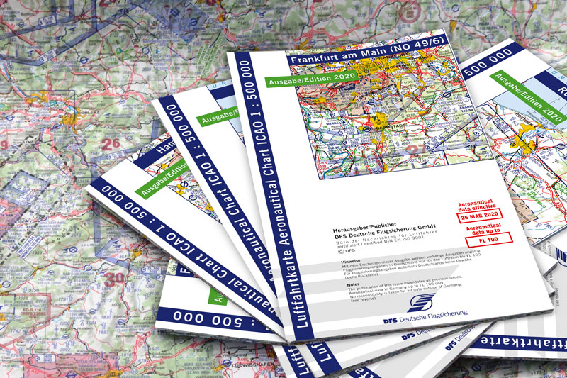
ICAO Luftfahrtkarte 1:500.000
Veränderte Darstellung Ausgabe 2025
Durch die Umstellung der Kartenproduktion auf ein neues Verfahren durch die DFS Deutsche Flugsicherung kommt es in der Ausgabe 2025 zu einigen Änderungen, die beachtet werden müssen.
Eine Übersicht der wichtigsten Änderungen und der Link zum offiziellen SUP der DFS siehe weiter unten. » Direkt zu den Änderungen springen
Die DFS Deutsche Flugsicherung GmbH bringt jedes Frühjahr eine neue ICAO-Karte 1:500.000 für Deutschland heraus.
Wir beantworten hier die häufigsten Fragen zur ICAO-Karte Deutschland.
Weitere Inhalte zu den ICAO-Karten:
» weiter zu: Wie geht ICAO-Karte?

Die häufigsten Fragen
Die DFS Deutsche Flugsicherung GmbH bringt jedes Frühjahr eine neue ICAO-Karte 1:500.000 für Deutschland heraus.
Wir beantworten hier die häufigsten Fragen zur ICAO-Karte Deutschland.

Is the ICAO chart 1:500 000 of DFS official? Is there only one ICAO chart for Germany?
There is only one ICAO chart for Germany and it comes from DFS. The ICAO chart 1:500 000 is the official VFR route chart of the Federal Republic of Germany.
There is a framework agreement between DFS and the Federal Minister of Transport that DFS performs the air navigation services tasks specified in Article 27 c (2) LuftVG on behalf of the Federal Government.
These include air navigation services, in particular air traffic services, communication services, navigation services, surveillance services, aeronautical information services and meteorological services.
Aeronautical information services also include the production and publication of aeronautical charts.
Although charts from other providers are also produced according to ICAO specifications, only DFS has the mandate from the Federal Government to produce the ICAO chart. Therefore, DFS also guarantees the content and is liable for self-inflicted errors.
Therefore, only official aeronautical information is processed for the production of the chart.
Do I have to buy a new card every year?
The 3rd Implementing Regulation to the LuftBO states that airplanes and helicopters must always be equipped with up-to-date charts suitable for the planned flight route and possible alternate routes according to the type of operation.

Is the ICAO chart 1:500 000 of DFS up-to-date?
Every year in spring, at the beginning of the flying season, DFS publishes a new ICAO chart for Germany. When it is published, the chart represents the valid airspace structure according to the date printed on it (e.g. Effective 24 MAR 22). Further information will be processed until the chart is finalized. The status for processing foreign data is printed on the back of the chart.
The card is then valid for one year, until the next card is released. Selected updates to the ICAO chart 1:500 000 are published continuously in the AIP VFR on pages GEN 0-33 ff. Significant changes to the content of the chart are also published as NOTAM.
If there are very major changes, DFS and Eisenschmidt will also provide additional information via the usual communication channels (social media, newsletter, homepage).
For safety reasons (= not up-to-date data), charts from the previous year may no longer be sold for the purpose of flight preparation and execution after the new chart has been published. Even for use for these purposes, the maps should always be up to date.
Have I discovered a mistake ...?
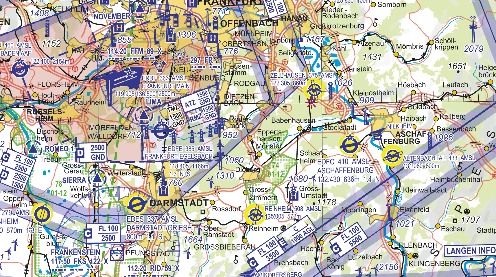
Perhaps you have also had the impression that something is wrong on the ICAO chart. The most common "error" messages we receive are explained here.
|
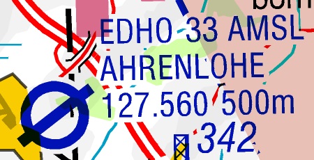
Die Flugplatzfrequenz ist falsch. Es wird die von der Bundesnetzagentur für Elektrizität, Gas, Telekommunikation, Post und Eisenbahnen zugeteilte und von dem Bundesaufsichtsamt für Flugsicherung genehmigte Frequenz veröffentlicht. |
|
|
Die Flugplatzfrequenz ist falsch. Es wird die von der Bundesnetzagentur für Elektrizität, Gas, Telekommunikation, Post und Eisenbahnen zugeteilte und von dem Bundesaufsichtsamt für Flugsicherung genehmigte Frequenz veröffentlicht. |
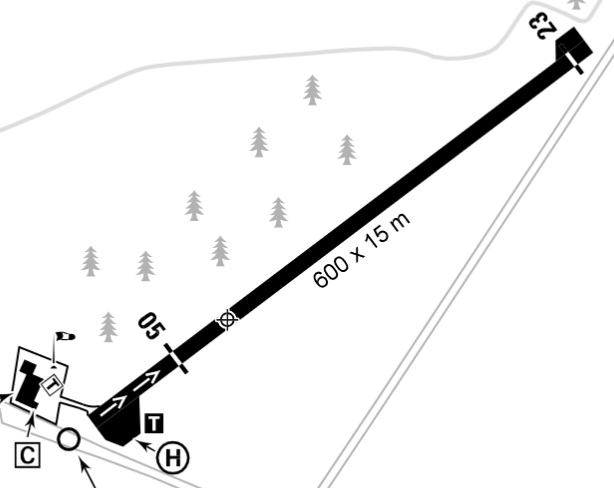
Angaben über die Landebahnlänge
|
|
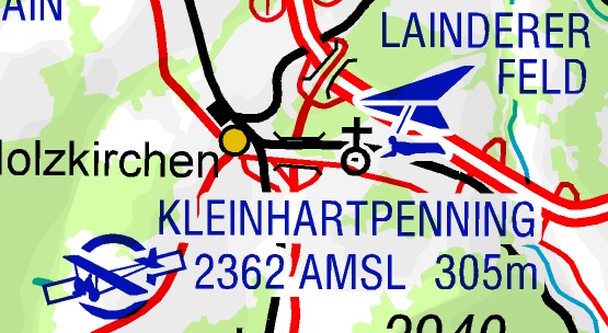
Ein Flugplatz ist in der ICAO-Karte dargestellt, in der AIP VFR ist jedoch keine Sichtanflugkarte. Im AIP VFR befinden sich Sichtanflugkarten nur für Flugplätze, die öffentlich sind. Einzelne Flugplätze sind bspw. nur für ortsansässige Piloten nutzbar. |
|
Es fehlt ein UL-Gelände in der Karte. In Absprache mit den Landesgenehmigungsbehörden werden nicht alle bekannten UL-Fluggelände dargestellt, bspw. wenn sie nicht öffentlich sind. |
|
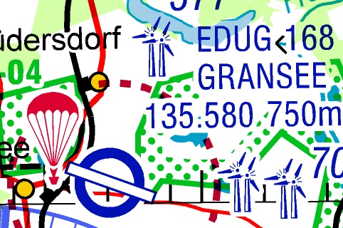
Es fehlt eine Windkraftanlage in der Karte. Hindernisse mit einer Höhe von weniger als unter 100m über Grund werden nicht dargestellt. |
Flugplatz ist nicht der AIP VFR
|
|
Der Hinweis auf ein verfügbares VDF(QDM) -der Unterstrich bei der Frequenz - fehlt in der Karte. Seit der Inbetriebnahme von Flugfunkgeräten mit 8.33 kHz-Raster bieten nur sehr wenige Flugplätze ein QDM an. Die Verfügbarkeit ist im Kopf der AIP VFR-Sichtanflugkarte der betreffenden Flugplätze dargestellt. |
|
Es fehlt ein Hängegleiter-/Gleitschirm-Fluggebiet in der Karte. Es werden nur Gelände mit Windenschlepp und einer Ausklinkhöhe von mehr als 150 m über Grund sowie intensiv genutzte Gelände dargestellt. |
Es fehlt ein UL- oder HG-Gelände
|

Where does the ICAO chart get its name?
The International Civil Aviation Organization (ICAO) is a specialized agency of the United Nations (UN). It draws up specifications, standards and guidelines for international civil aviation. The Federal Republic of Germany is a member of the ICAO, as are almost all countries in the world.
One of the requirements is that a member state must publish certain publications (Aeronautical Information Publication AIP) and aeronautical charts. The mandatory publications also include a VFR route chart, hence the name ICAO chart.
What data sources are used for the map?
For the German national territory, only official and official aeronautical information is processed. On foreign territory, the official Aeronautical Information Publication (AIP) of the respective countries is largely evaluated.